


Custom designed illustrated maps, locator maps & site plans
that draw people to your business!
that draw people to your business!
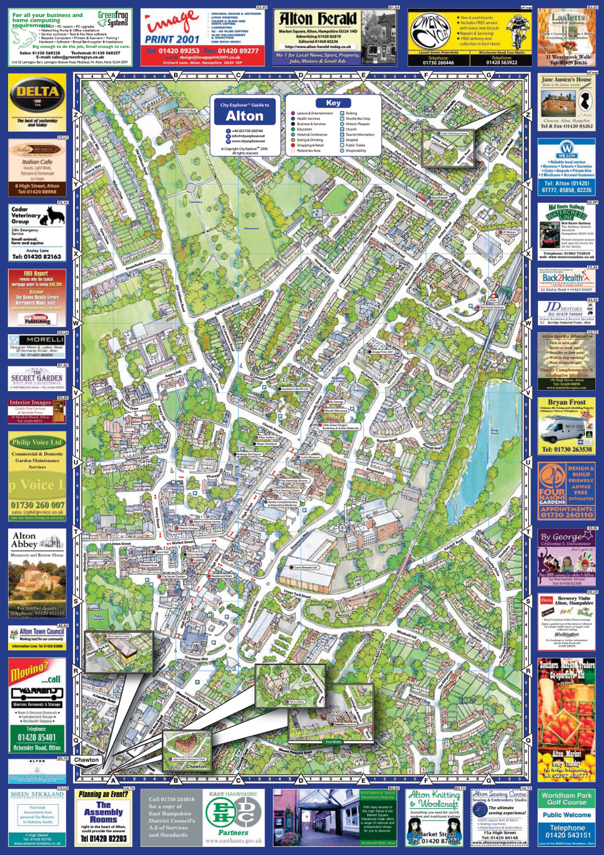
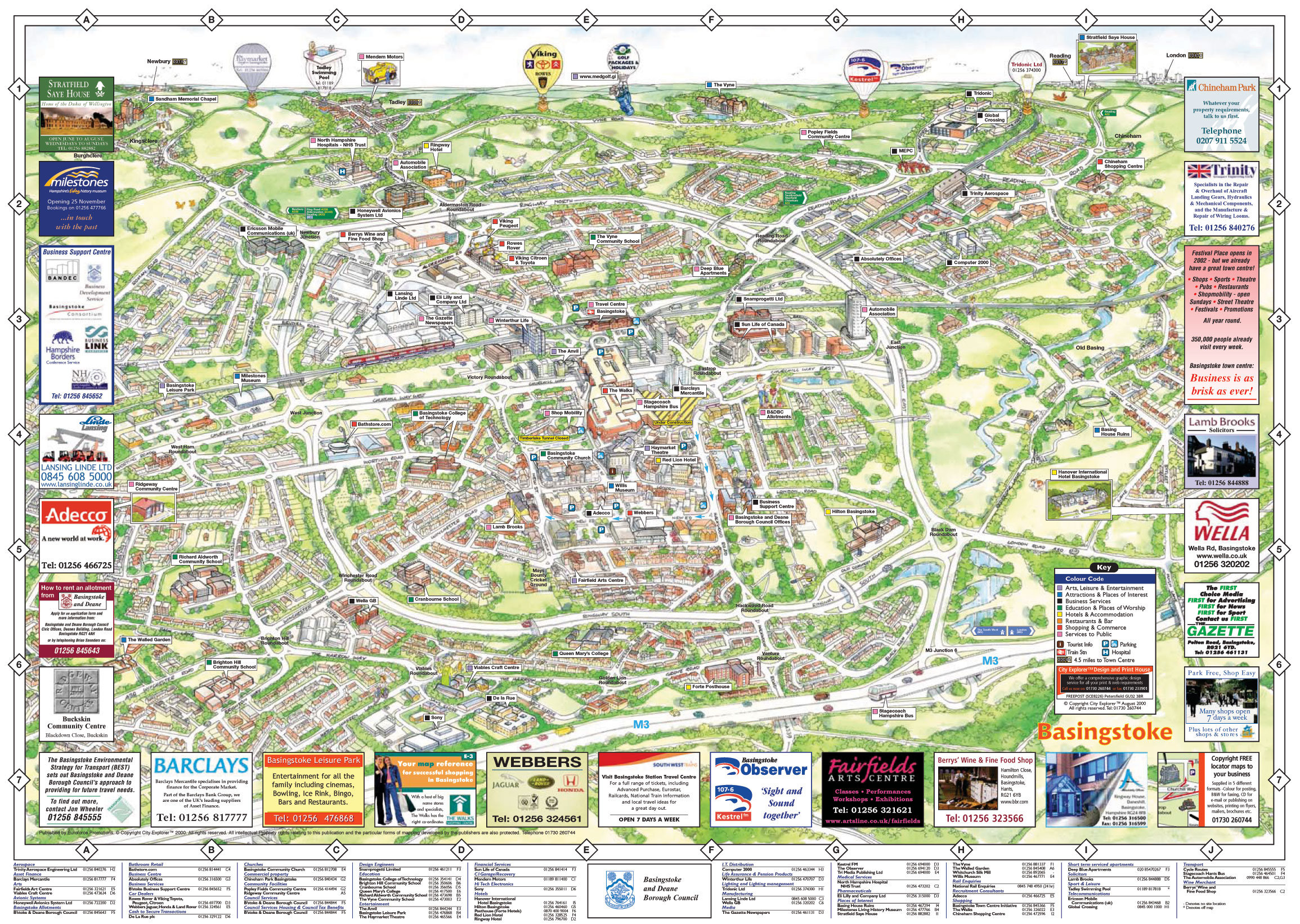
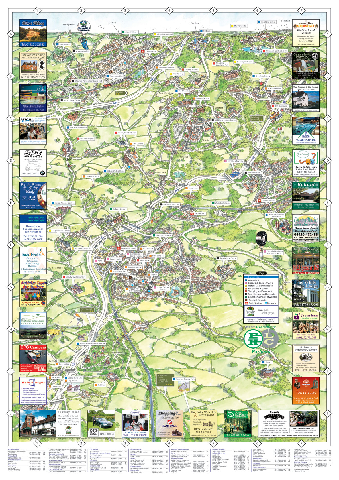
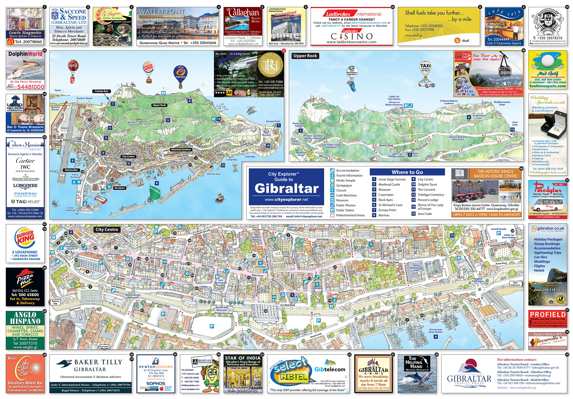
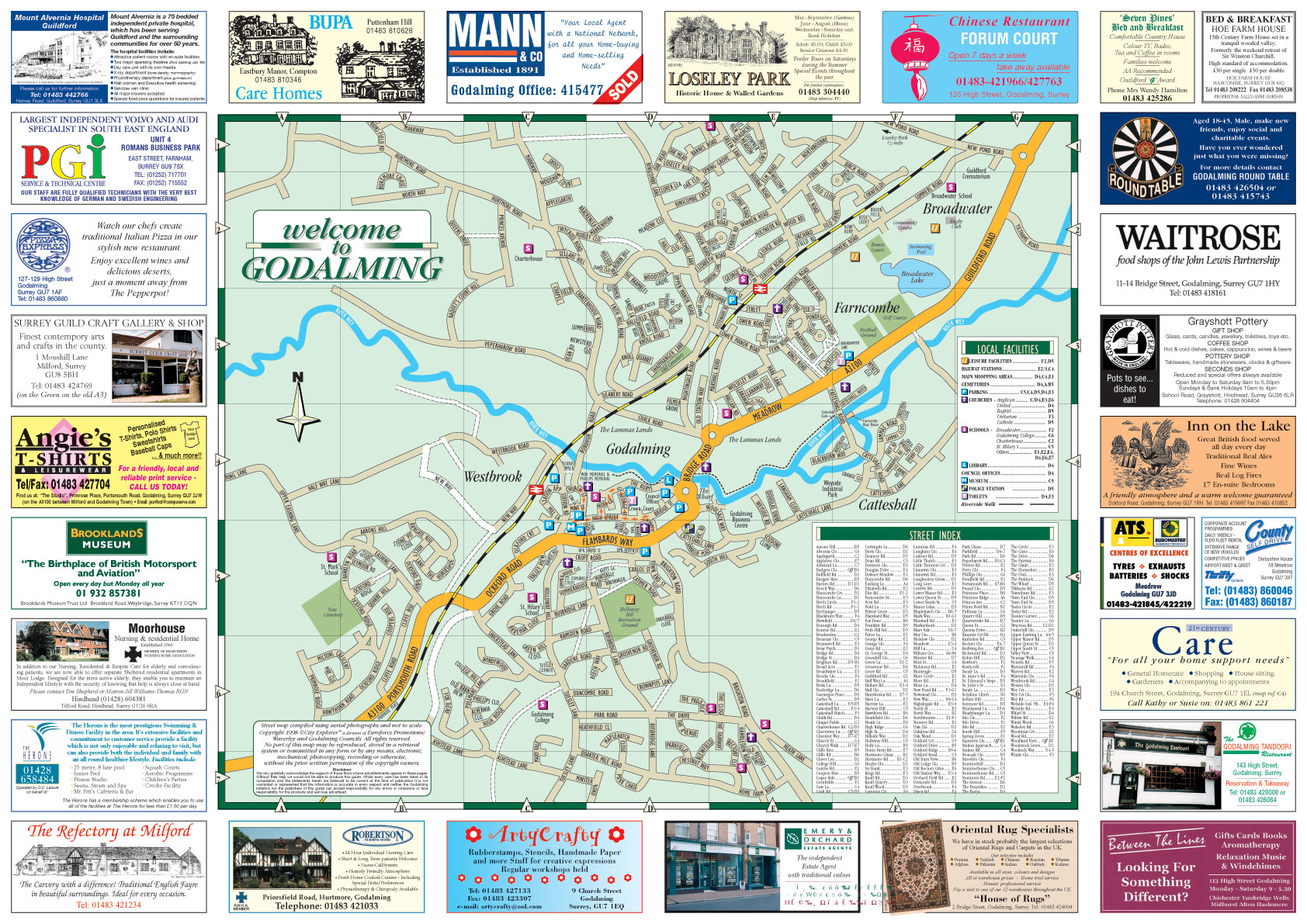
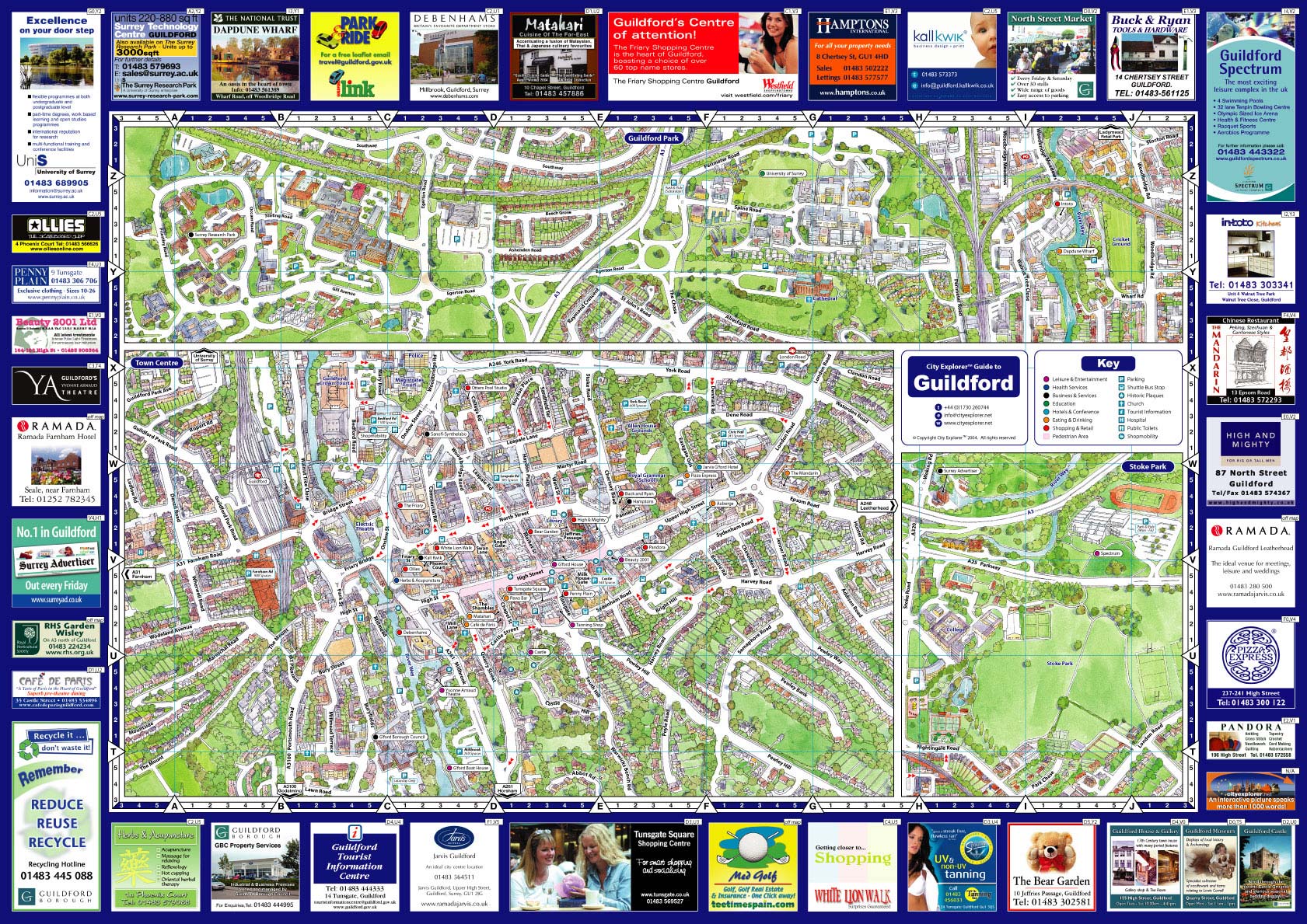
City Explorer™ have been producing 3-D illustrated maps, guides, locator maps, site plans and cartoon fun maps for over 25 years.
Our popular guides have been published and distributed for cities and towns in Europe, Canada and the USA. These beautifully illustrated birds eye view illustrated aerial maps are used to visually promote the unique characteristics, attractions, services and features and businesses of any city, town, campus or destination. They are not only eye-catching but prove to be extremely successful at drawing customers to participating businesses in towns, cities and destinations and are the ideal solution to help mark or commemorate any special event.
Our Custom Maps Offer Everything You Need In A Map and More!
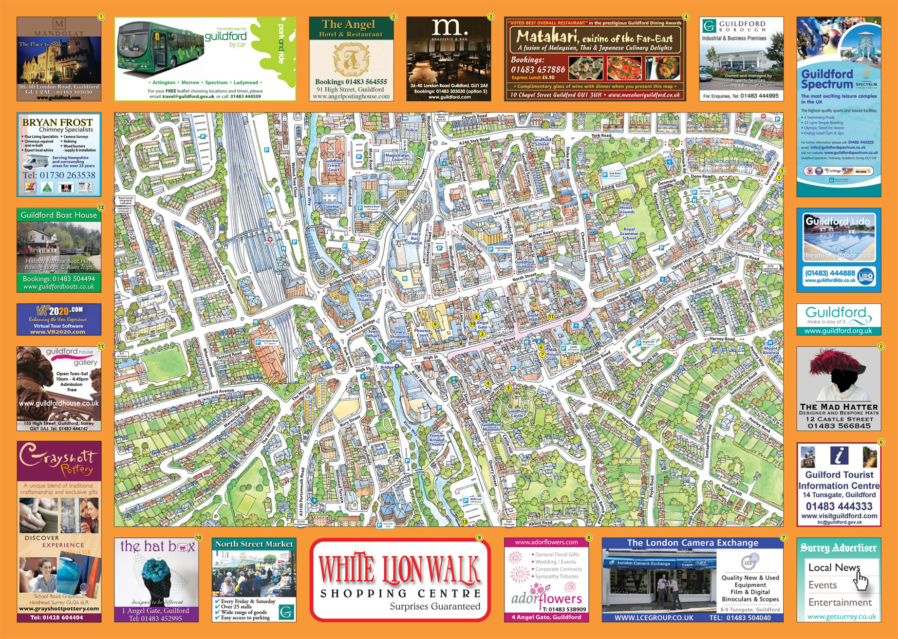
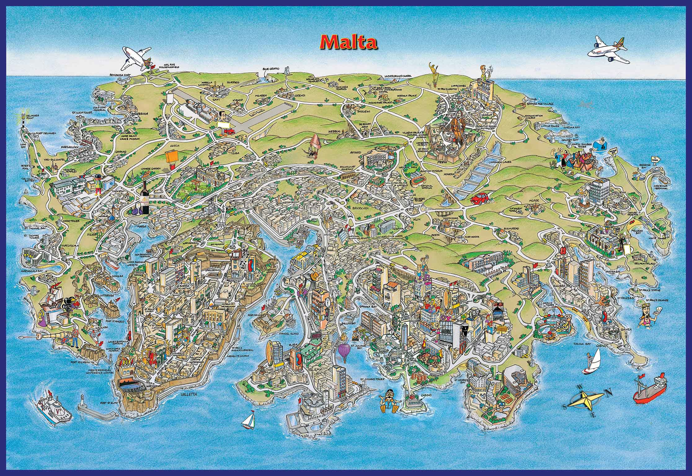
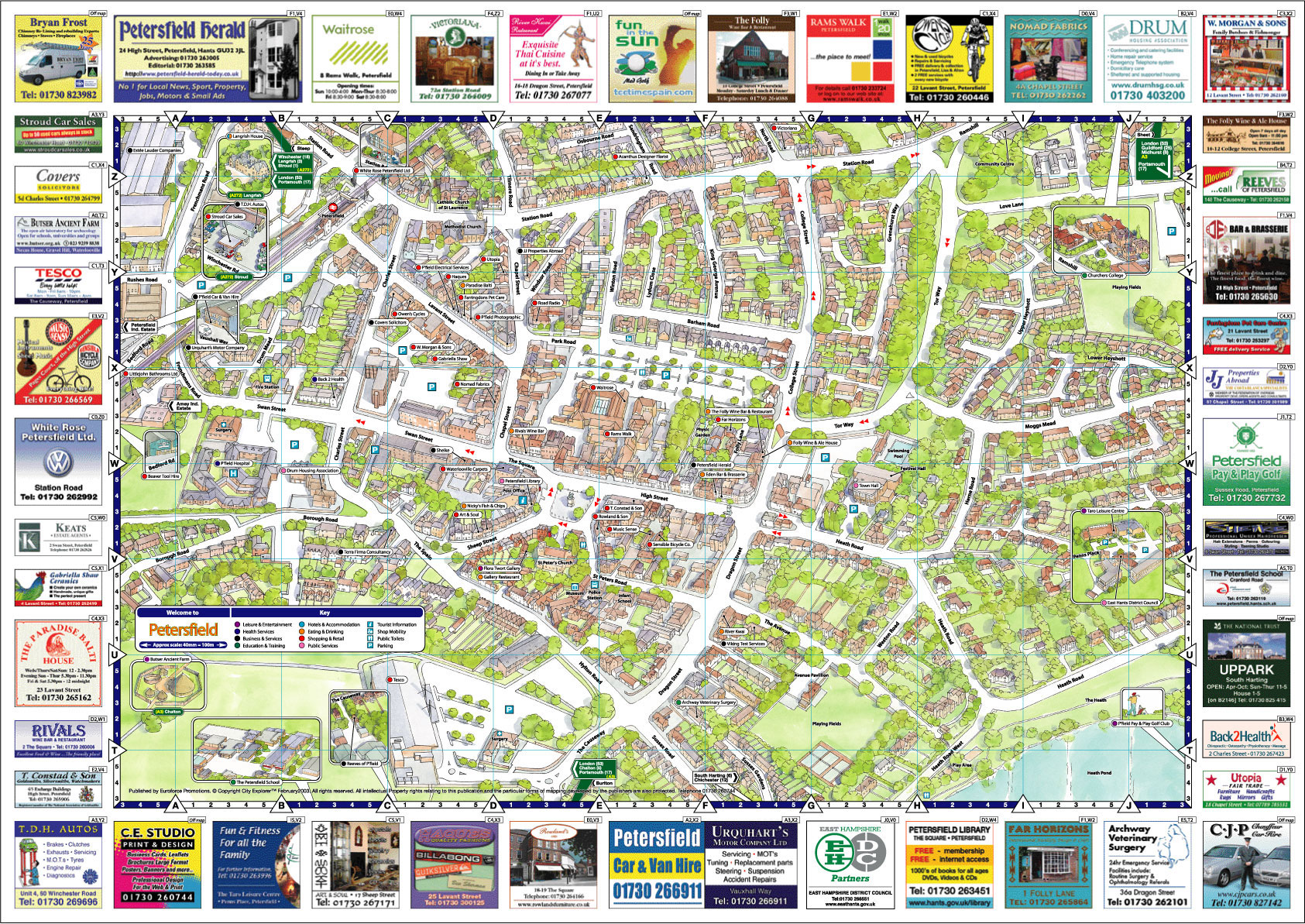
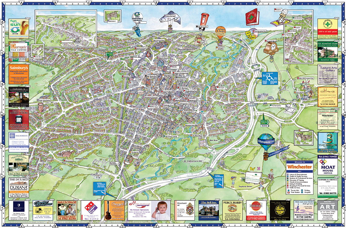
The attractive and detailed map illustration offers a visual, simple and informative way of exploring a city, town or destination as well as offering an intuitive and unique way for people to re-acquaint themselves with local independent shops, businesses and services in their area.
The City Explorer™ illustrated 3-D aerial maps and guides have been produced since 1989 and the popularity of the publications with both sponsors and clients in North America and Europe has contributed to the company's long-term success. It is through our commitment to listen to our clients needs that City Explorer have adapted the mapping style from a ‘cartoon map’ or ‘fun map’ into a comprehensive detailed birds eye view drawing.
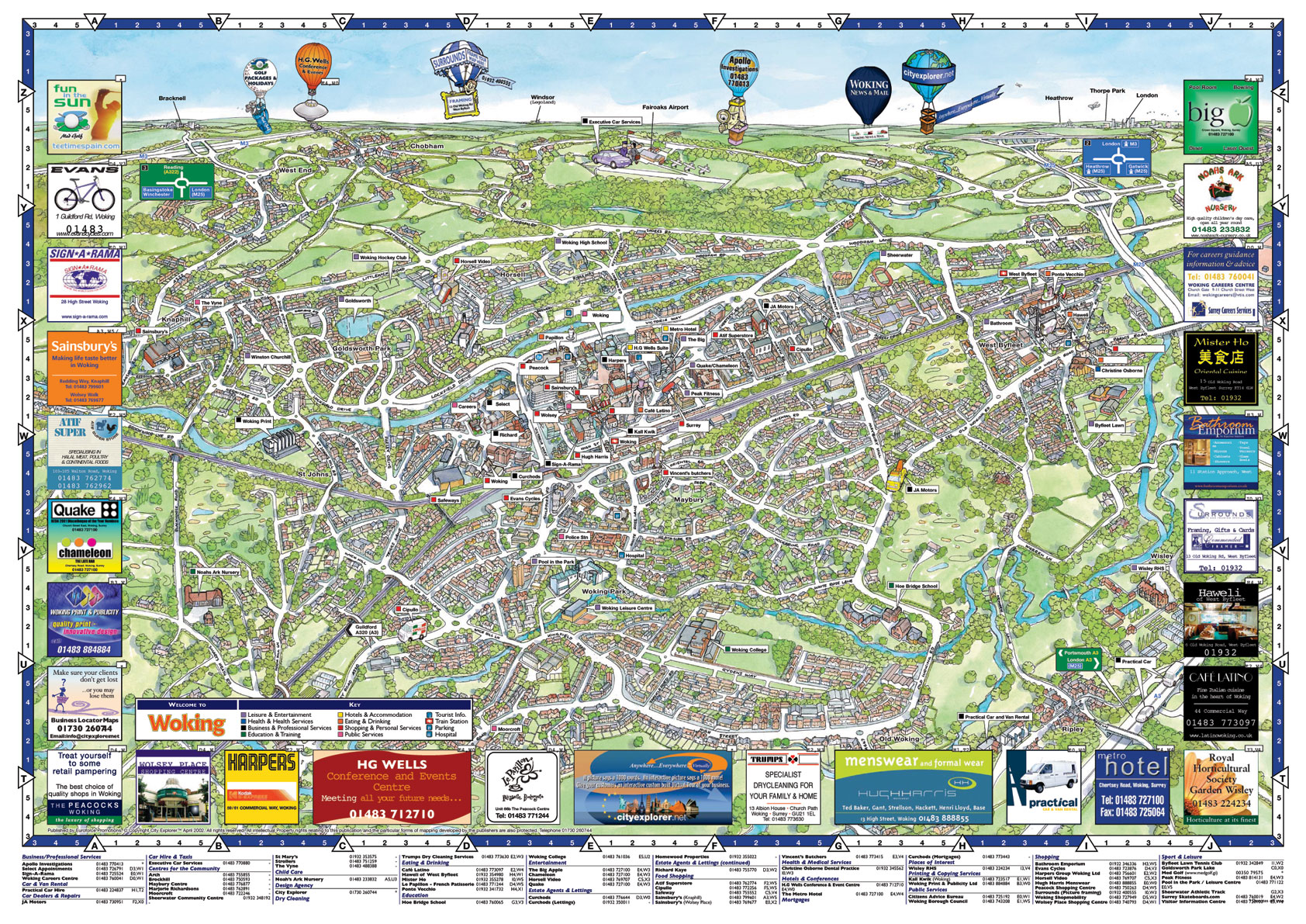
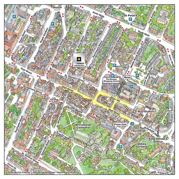
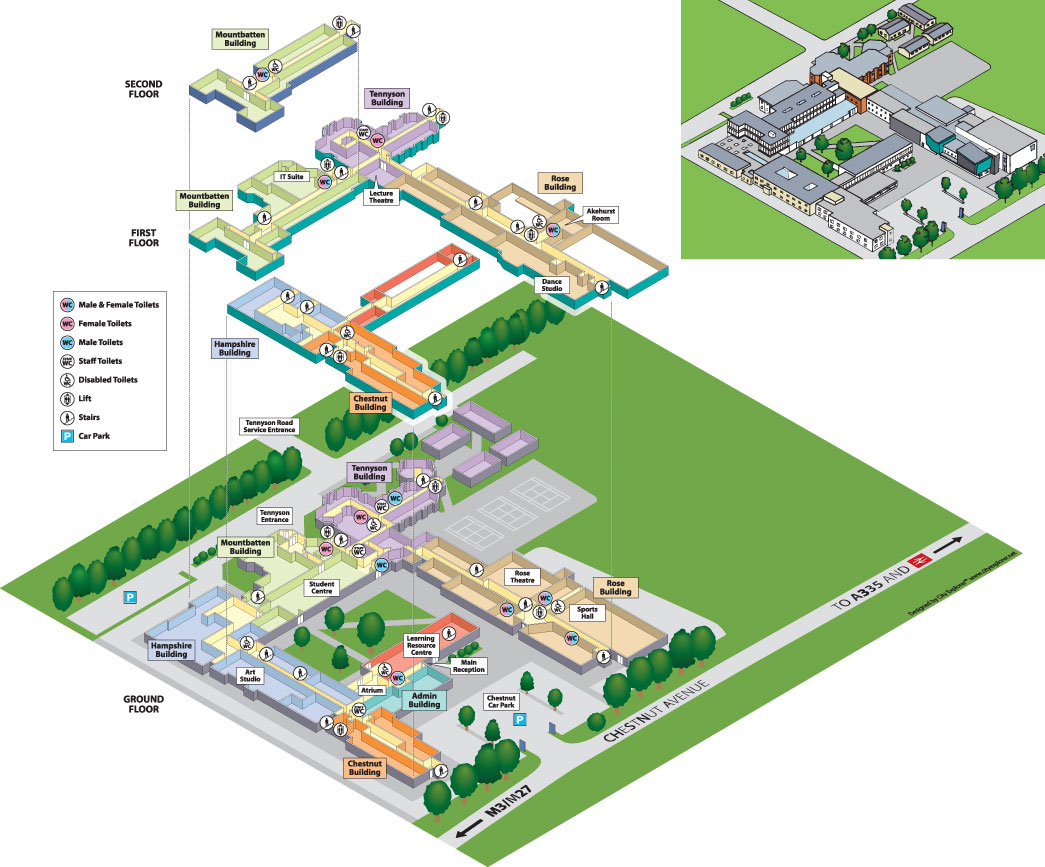
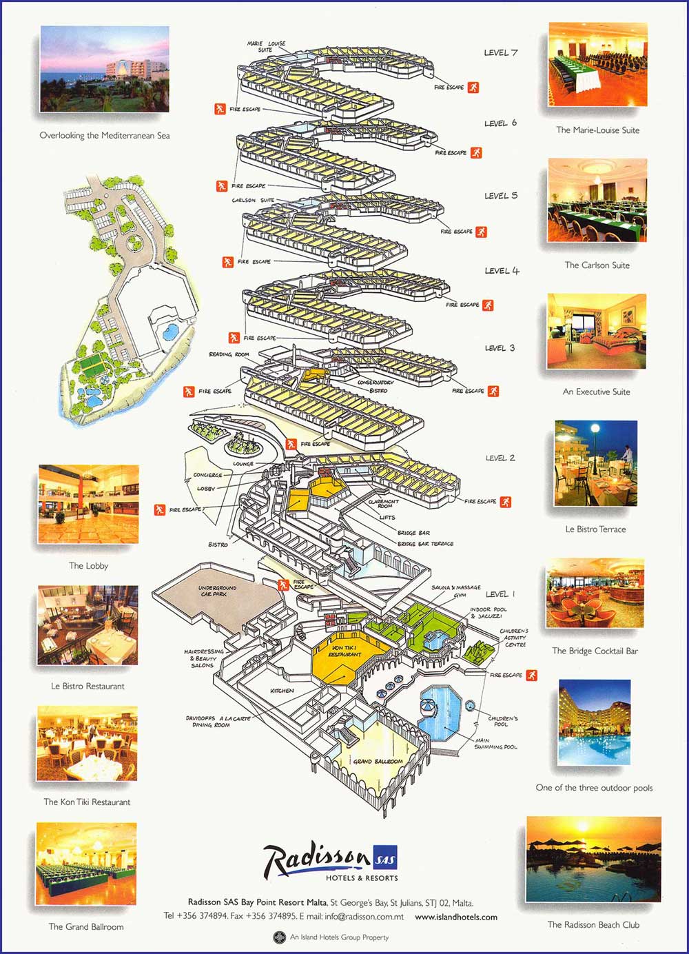
Illustrated Map Samples


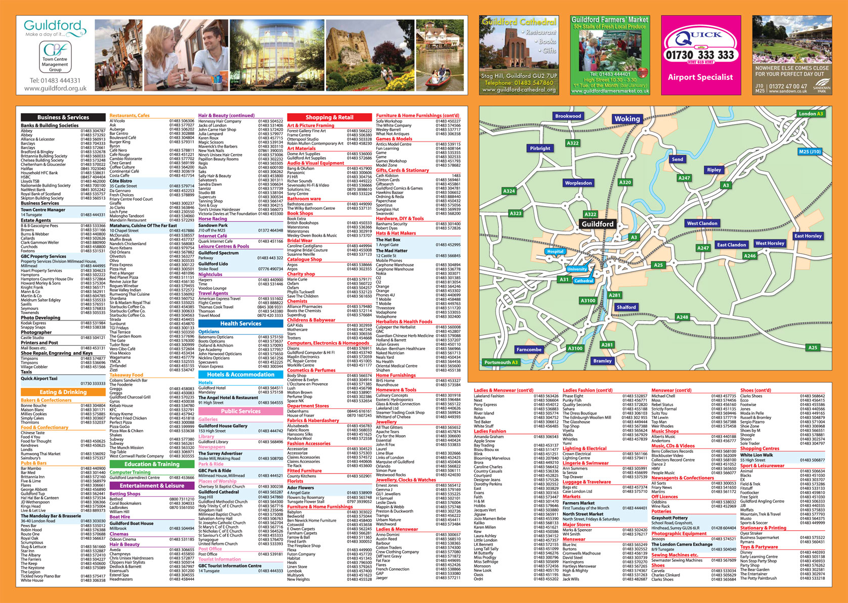


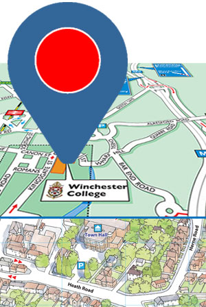
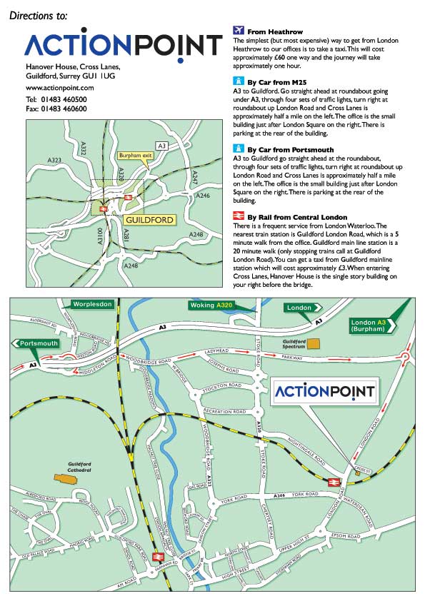
Custom Designed Locator Maps
- Shows the most direct and easiest routes to your office by foot or transport.
- Your customised maps are supplied Royalty FREE for your unlimited use.
- Supplied to you in different formats for use in print, brochures, flyers, websites, e-mail, posting or faxing.

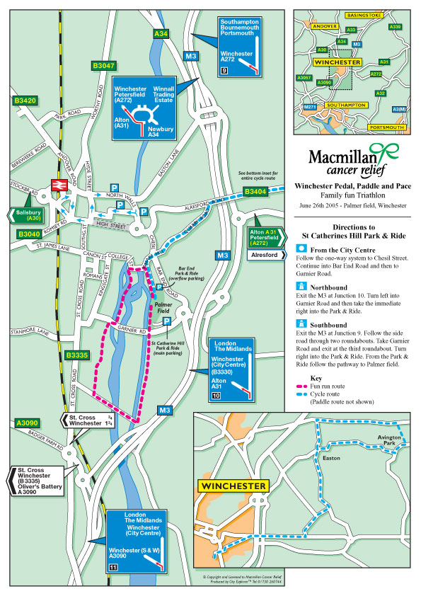
Locator Map Samples
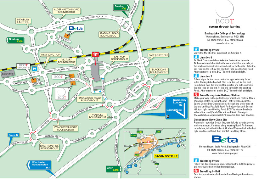
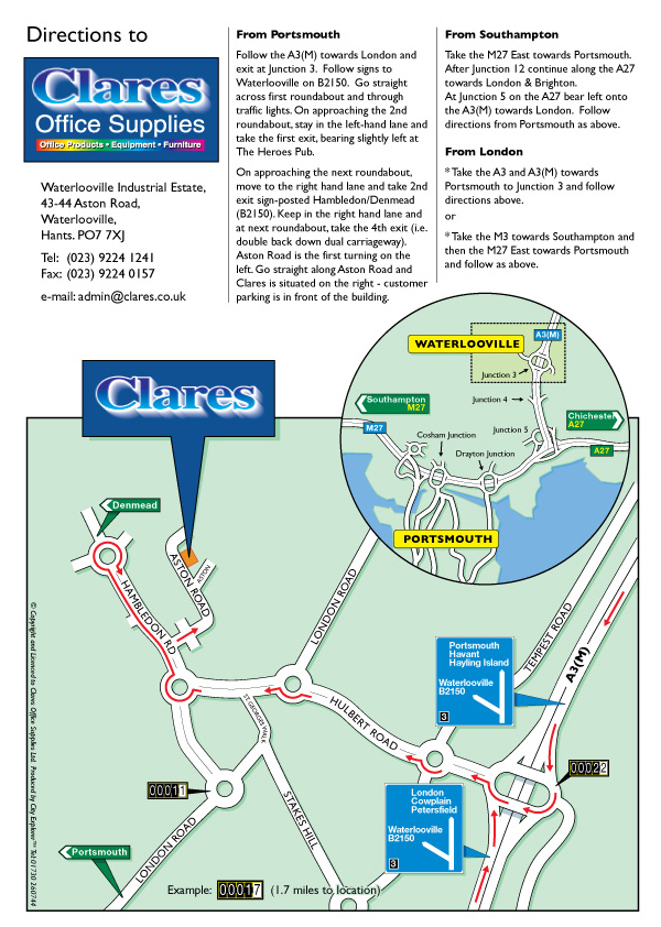

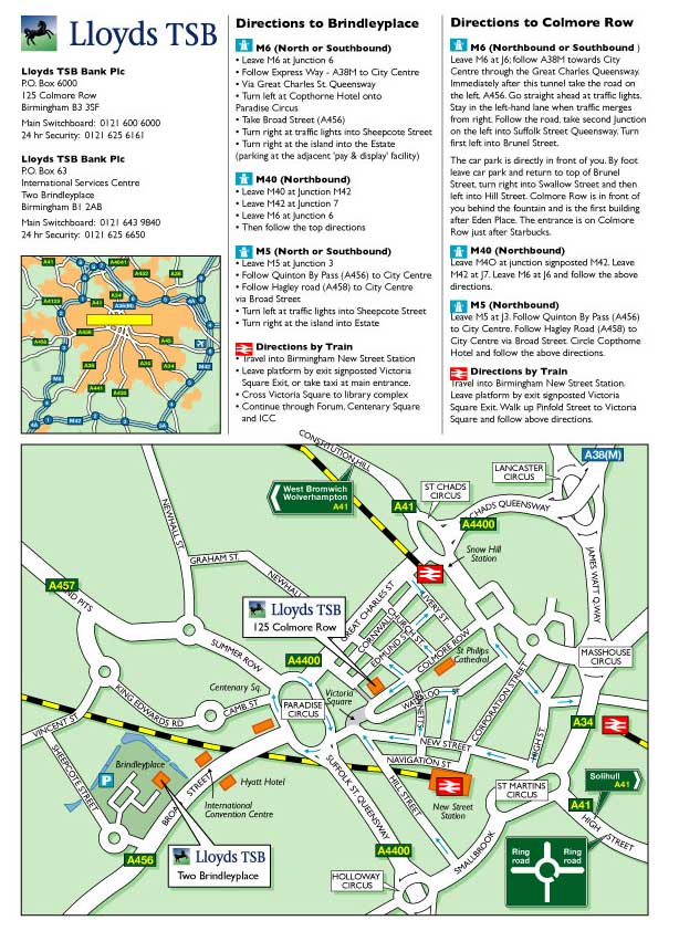
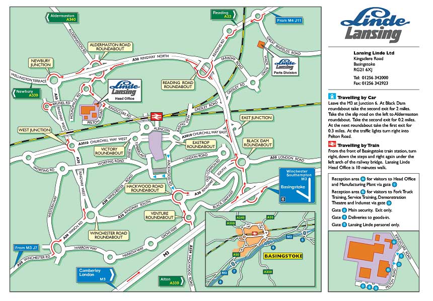
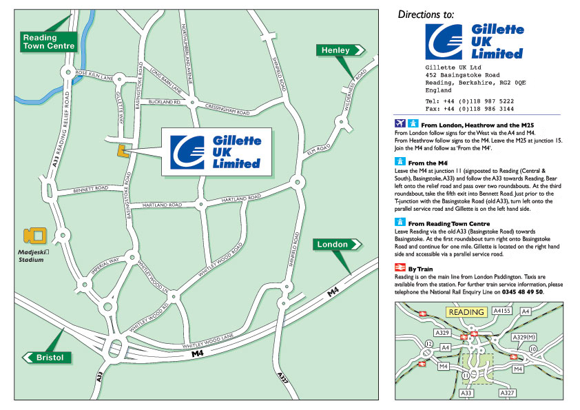
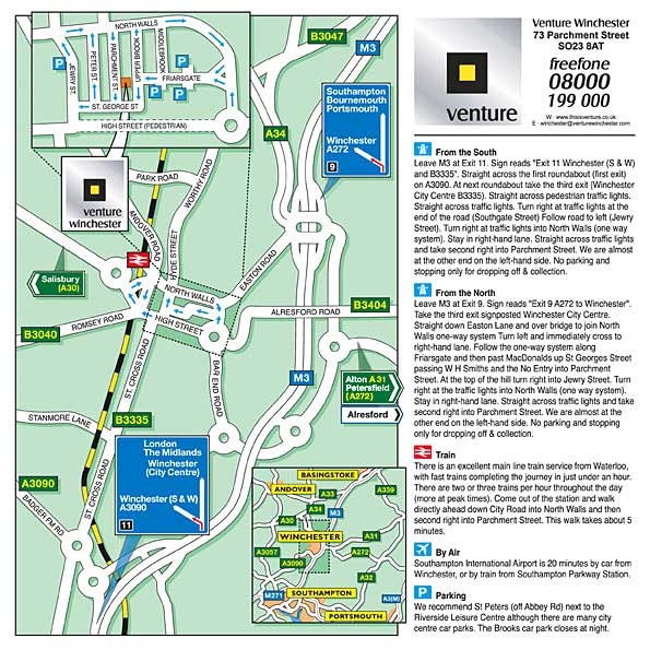
Professionally Designed Royalty FREE Locator Maps include:
- Major landmarks can be illustrated.
- Duplication of the actual road signs
- Simplified road layouts
- Arrows to indicate the correct route
- Supplied in colour and in black&white
- Supplied to you on CD for use in brochures, flyers, websites, e-mail, posting, faxing and more.
- Each route or mode of transport can be shown and explained.
- Every map designed to your personal specification, for any requirement and format.